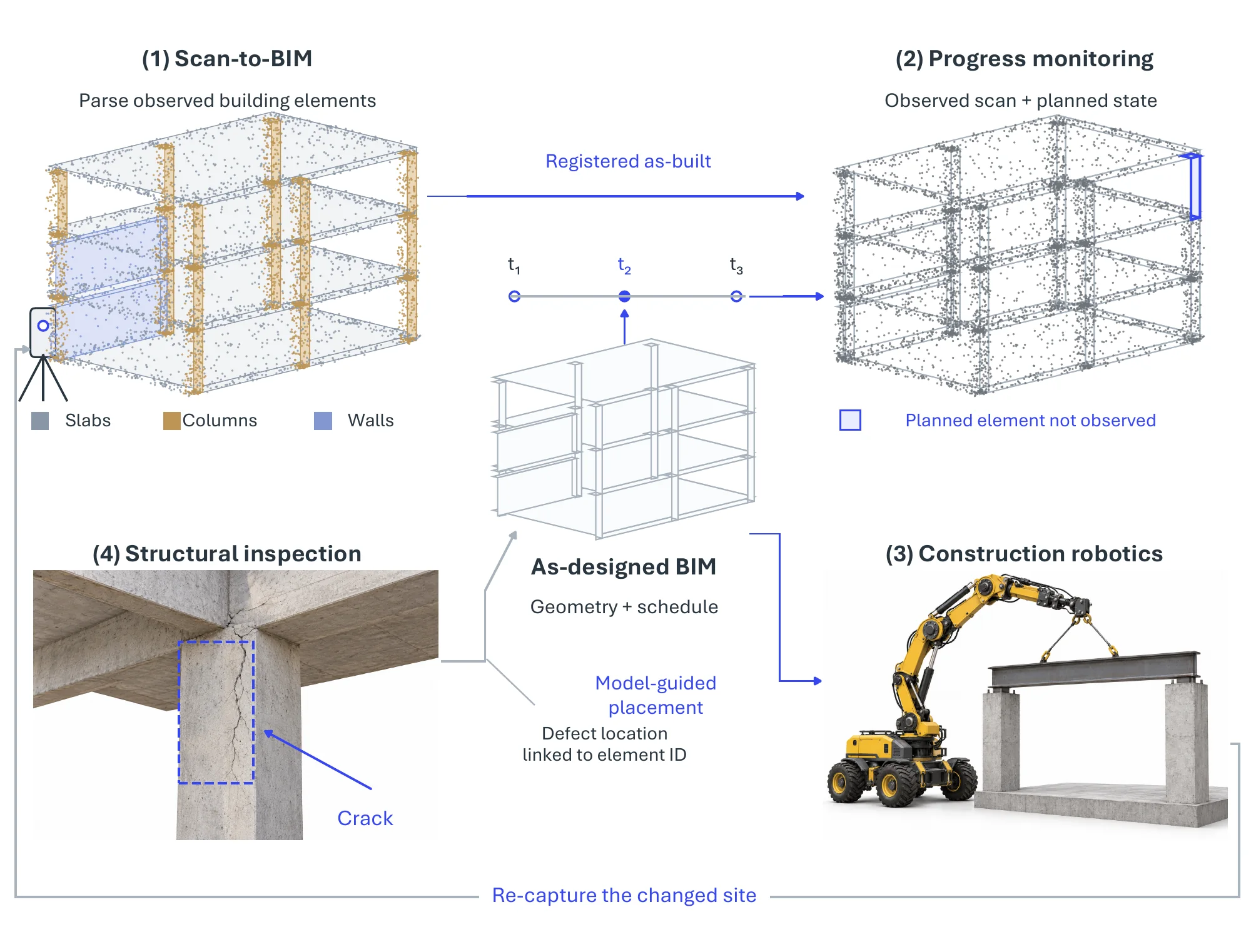
The architecture, engineering, and construction (AEC) sector is built around a single spatial-intelligence problem: continuously registering the messy as-built reality of a site against the structured as-designed model that specifies what it should become. This is the same Building-Information-Modeling (BIM) substrate that anchors the city-scale digital twins of Section 11.1, but here the model is the working blueprint of an individual building under construction rather than a synchronized replica of a finished one, and the central task is detecting and acting on the discrepancy between plan and reality. Figure 14.1 sketches this as-built versus as-designed loop. Scan-to-BIM is its perception front end: dense laser or photogrammetric scans of a structure are semantically parsed into walls, floors, columns, and components, building on the indoor point-cloud understanding of Chapter 6 and its benchmarks S3DIS [507] and ScanNet [448]. A specialized sub-problem is vectorizing a scan into an editable floorplan, where synthetic supervision such as Structured3D [1943] and transformer models that predict all room polygons in parallel [2976] now recover clean geometry from cluttered scans. Progress monitoring closes the loop in time: by registering an image-based or scanned as-built point cloud against a four-dimensional IFC-BIM model, deviations between planned and actual construction state can be recognized automatically [2977], the spatiotemporal core of the commercial reality-capture platforms now common on job sites. Construction robotics acts on the model directly, with mobile fabricators that localize against the design to print, place, or assemble structural elements at full scale [2978]. Finally, structural inspection turns the same perception stack toward maintenance, localizing cracks and defects on concrete surfaces from imagery [2979], increasingly from a UAV-borne 3D reconstruction of a bridge or facade. Reality-capture and BIM tooling from Matterport,1 Autodesk,2 and Leica,3 progress-monitoring services such as OpenSpace4 and Buildots,5 and on-site robots from Dusty Robotics6 and Built Robotics7 are representative of the deployed layer.